Hi.
we are currently working on a workflow for using LIDAR Scans in Augmented3d so we can better visualize whats going on on strage.
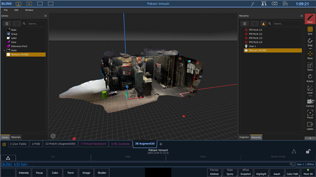
We did a few demos with Polycam exporting as a .glb and importing it directly into A3d which worked nicely.
Now we are wondering, how far we can take it. for example by scanning the whole house to have a photorealistic scale model in which we can place our lights.
since our house is pretty big we will probably shoot way past 10.000.000 Triangles without and lights and im worried if its too much to handle for A3d, even with a suficient Visualisation PC, because of the software integration or soft limits in the software.
Has anyone here done a really big LIDAR scan of their rig yet? how has it worked for you?
Heres a Screenshot of our small demo which already has 75k Triangles.


